Two waterfronts live side by side on Davis Islands: the calm, protected canals and the wide‑open sweep of Hillsborough Bay. If you’re eyeing a home here, the view is only half the story. Your decision should line up with your boating plans, elevation and insurance goals, and the condition of what you cannot see below the seawall. This guide breaks it all down so you can buy with confidence. Let’s dive in.
Davis Islands at a glance
Davis Islands sits just south of downtown Tampa on two man‑made islands built in the 1920s. You’ll find a small village of shops and restaurants on Davis Boulevard, several parks, a municipal marina/seaplane basin, and a general‑aviation airport. The lifestyle blends historic Mediterranean homes with contemporary luxury builds and quick access to the urban core. Get the neighborhood overview on the City of Tampa’s page for Davis Islands.
Pricing spans a wide range because the island mixes small bungalows with multi‑million‑dollar bayfront estates. Third‑party data providers reported a median sale price near $966K in Jan 2026, but figures vary widely depending on whether canal and open‑bay estates are included. Always confirm the most current numbers with active MLS data for the segment you’re targeting.
Canal vs open‑bay lots
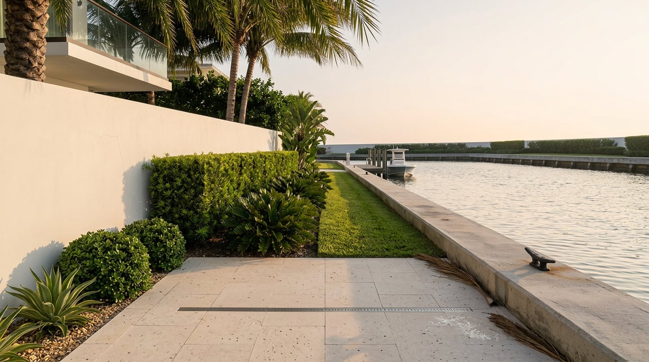
Canal lots: protected but variable
Canal properties typically offer calmer water and easier day‑to‑day dock use. Depth can vary by location and tide, and some canals may limit vessel draft or turning radius for larger yachts. Listings often tout “deep‑water canals,” but you should still verify depth and fairway geometry. For context on how depth and channel shape affect boat handling, see the EPA and USACE marina planning guidance on basins and channels.
Open‑bay frontage: scarce and premium
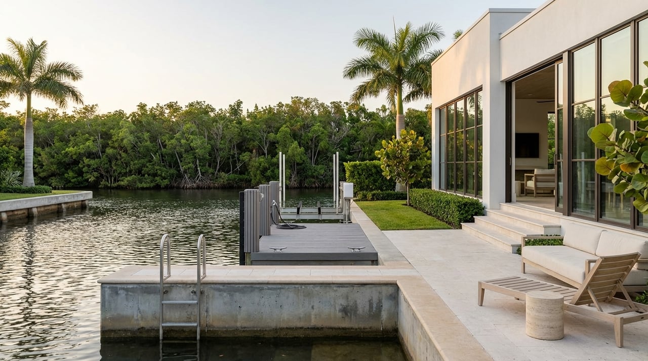
Open‑bay parcels face Hillsborough Bay with broad views and, in many cases, deeper water at the wall and faster access to open water. Marketing often highlights “no bridges to navigate.” These lots are scarce on Davis Islands and command a clear premium. If long‑range views and larger‑vessel flexibility matter, open‑bay frontage holds enduring value.
Match exposure to your boat
If you plan to berth a large motor yacht or prioritize quick runs to the Gulf, favor true bayfront lots and confirm depth along your approach. For smaller boats, tenders, or lift‑kept center consoles, a well‑sited canal home can deliver great function with lower acquisition and maintenance costs. Use local captains and marinas to ground‑truth listing claims before you write an offer.
Boating access and moorings
Davis Islands is an active boating hub. The Davis Island Yacht Club anchors the community, and municipal mooring and boardwalk improvements have been part of the city’s planning efforts. Policies and slip availability can change, so confirm membership rules and any municipal mooring details before you rely on them.
Navigation is straightforward for many homes because there are no fixed bridges between most island docks and the bay. Still, safe operation depends on verified channel depths, tides, and local shoaling. EPA and USACE guidance on marina channels underscores the importance of documented depths and fairway width when planning for larger vessels.
Permits matter on the shoreline. Docks, seawalls, bulkheads, and any dredging require permits at state and often federal levels, and the city manages local approvals. Review Florida water‑resource statutes and be sure any past seawall repairs or dock work were properly permitted and inspected. Start with Florida’s Chapter 373 water resources statutes on the Florida Senate site.
Elevation, flood, and long‑range risk
Davis Islands is built on dredged fill near mean sea level, so storm surge, tidal flooding, and long‑term sea‑level rise deserve real attention. Elevation relative to your Base Flood Elevation (BFE) is the key driver of flood risk and insurance cost. For context on the island’s origin and location, see the City’s page for Davis Islands.
Start with the FEMA Flood Insurance Rate Maps for your exact parcel and identify the effective flood zone and BFE. The FEMA Map Service Center explains how to get official panels and data; use the FEMA Map Service Center as your primary reference. If needed, obtain an Elevation Certificate to compare the lowest floor with BFE.
Plan with a long lens. Regional guidance for Tampa Bay uses NOAA‑adjusted sea‑level rise scenarios from roughly 1.9 feet (intermediate‑low) to 3.9 feet (intermediate) to 8.5 feet (high) between 2000 and 2100. Review the Tampa Bay curves in the NOAA Sea Grant report on regional sea‑level rise scenarios. Local researchers also highlight how older homes often sit lower than newer, elevated construction; see USF’s work on 3D scanning and hurricane flood risk in Tampa (USF article).
Insurance and building rules tie into elevation. In Special Flood Hazard Areas, lenders generally require flood insurance for federally backed mortgages. The City’s substantial‑improvement rule (the 50% rule) can force compliant elevation if you renovate beyond certain thresholds. Review local hurricane and permitting guidance on the City’s Hurricane Information page and price out both NFIP and private flood options based on an Elevation Certificate.
Practical steps:
- Pull the FEMA FIRM panel, zone, and BFE for the parcel, then request any existing Elevation Certificate.
- Order a current boundary and elevation survey to verify lowest finished floor against BFE.
- Get flood quotes from NFIP and private carriers using your Elevation Certificate and any known claims history.
- If you plan to rebuild, budget for elevated living floors and deep foundations to meet or exceed BFE plus freeboard.
Property types and construction choices
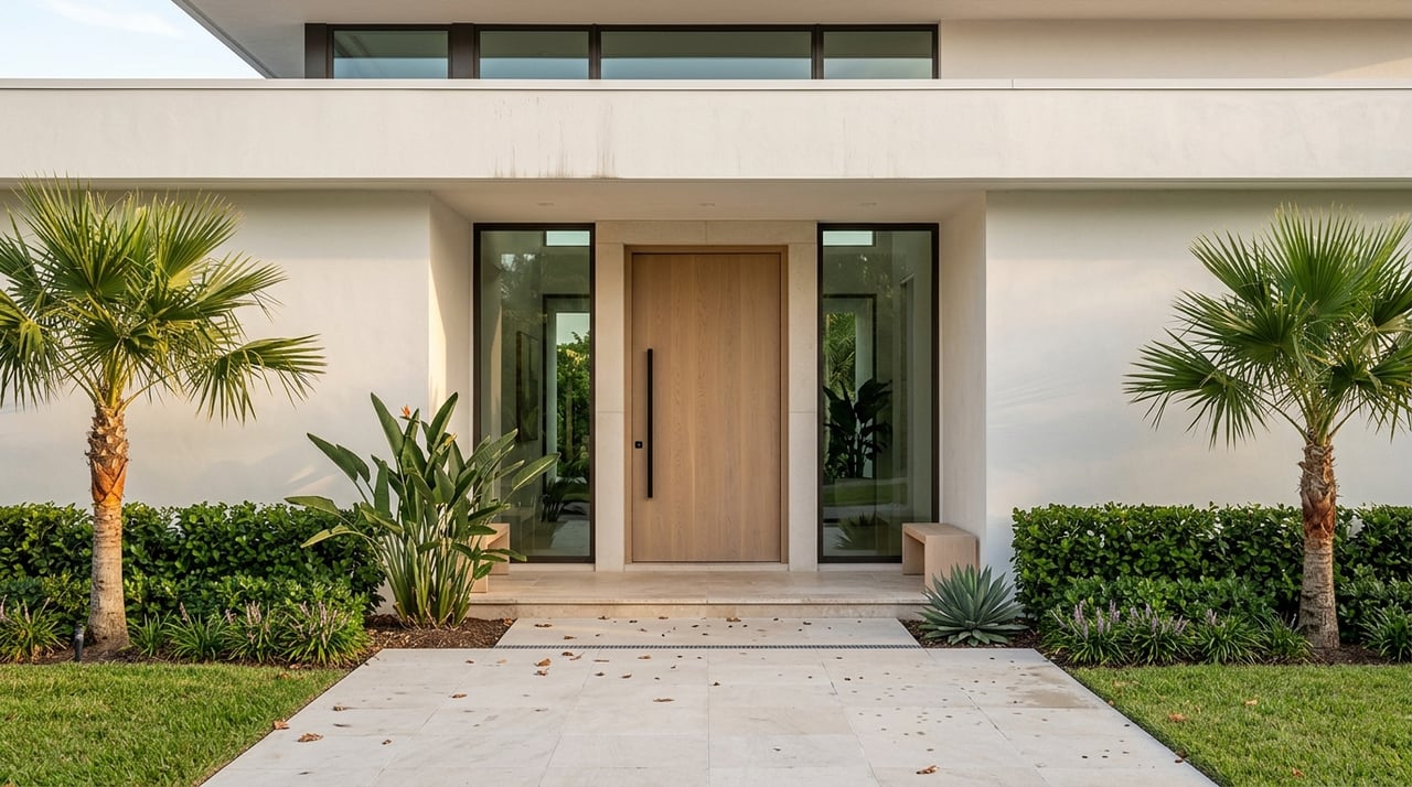
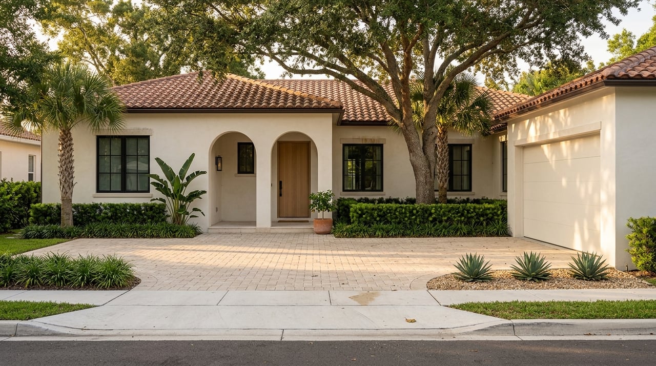
Inventory runs from 1920s Mediterranean and mid‑century ranches to new, custom estates. Many newer luxury builds use deep piles, poured concrete and steel, impact glazing, elevated living floors, whole‑house generators, and multi‑car garages. These choices reflect both waterfront resilience and modern luxury expectations.
Seawall and dock condition is a major value lever. A waterfront that looks pristine can hide issues like undermining, toe scour, bowing, or corroded rebar. A marine‑structural inspection is standard on Davis Islands and should assess seawall integrity, piles, and hardware, plus any need for dredging by the owner or municipality. For a clear primer, see this overview of seawall and dock basics for Tampa Bay buyers.
Pricing and value drivers
Because Davis Islands mixes modest homes with trophy bayfront estates, data can be noisy. One third‑party provider reported a median sale price near $966K in Jan 2026, while luxury bayfront listings and sales often run into the multi‑million range, with exceptional estates reaching well above $10–20M. The biggest drivers of value are exposure (open‑bay scarcity), usable frontage and depth for your vessel, elevation relative to BFE, and the condition and permitting of the seawall and dock.
To make smart comparisons, segment your search by exposure type, elevation profile, and boat requirements rather than relying on a single island‑wide median. Then confirm today’s pricing with current MLS data for your specific product type.
Neighborhood comparisons
- Harbour Island: Closer to Water Street and more condo and gated enclaves. Choose Harbour Island if you want a low‑maintenance, amenity‑driven condo lifestyle. Choose Davis Islands if you want single‑family lots, private yards, and canal or open‑bay frontage minutes from downtown.
- Ballast Point and Beach Park: Each offers its own waterfront pockets and lot patterns. Some streets in these areas sit higher than portions of Davis Islands, but product mix and boating access differ neighborhood to neighborhood.
- Palma Ceia and broader South Tampa: Excellent central locations with historic character and tree‑lined streets. Waterfront options are more limited than on Davis Islands.
Use this simple framework when comparing: vessel size and navigation ease, desired lot frontage and privacy, flood‑risk tolerance and mitigation cost, and proximity to the city’s business and dining hubs.
Buyer due‑diligence checklist
- Confirm FEMA flood zone and BFE via the FEMA Map Service Center and obtain any existing Elevation Certificate.
- Ask for seller disclosures, including any past flood claims and prior flood policies, then price NFIP and private flood using the Elevation Certificate.
- Order an ALTA/ACSM survey with elevations to verify lowest floor vs. BFE and locate improvements and encroachments.
- Commission a seawall and dock inspection, including piles, tie‑backs, anchors, and toe protection; verify any dredging history and responsibilities.
- Verify channel approach depths and fairway width for your intended vessel. Use local captains and marina operators to ground‑truth draft and turning needs.
- Confirm permitting history for the seawall, dock, and any post‑storm repairs. Ensure work was inspected and closed out.
- If planning a new build or major renovation, require a geotechnical report and a schematic foundation plan reflecting fill soils and BFE plus freeboard.
- Review the City’s substantial‑improvement thresholds and renovation implications for design, timing, and insurance.
Ready to explore Davis Islands?
Waterfront on Davis Islands rewards buyers who align lifestyle, boating, and elevation from day one. If you want curated access to canal and open‑bay opportunities, private placement into off‑market options, and smart due diligence from the start, connect with Bianca Lopez. You’ll get neighborhood‑first advice, developer‑grade insight on construction and permitting, and a clear plan to secure the right home.
FAQs
What’s the difference between canal and open‑bay homes on Davis Islands?
- Canal lots offer protected water and often easier dock use, while open‑bay frontage delivers wider views, faster bay access, and premium long‑term value.
How should a Davis Islands buyer evaluate flood risk and insurance?
- Pull FEMA maps and BFE, obtain an Elevation Certificate, compare lowest floor to BFE, and price both NFIP and private flood to align coverage with your risk.
What permits are required for docks, seawalls, or dredging on Davis Islands?
- Expect state and local permits, and sometimes federal review; confirm that past repairs were permitted and inspected before you buy.
Is there yacht club or marina access on Davis Islands?
- Yes; the Davis Island Yacht Club and municipal moorings serve local boaters, but you should verify membership options and slip availability directly.
How do Davis Islands prices compare across Tampa waterfront areas?
- Prices vary widely by exposure, frontage, elevation, and home age; segment by product type and verify current MLS data rather than relying on a single median.